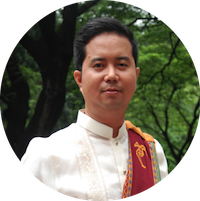
 Dr. Ariel Blanco is currently an Associate Professor of Geodetic Engineering at the University of the Philippines Diliman. He started his 21-year academic career as Instructor in 1998; promoted to Assistant Professor in 2003; and then to Associate
Professor in 2014. He holds the following degrees: BS Geodetic Engineering (1997, GE Study Grantee) from the UP Diliman; Master of Applied Science in Geographic Information Systems (2003, ADB- JSP Scholar) from the University of Melbourne (Australia), and; Doctor of Engineering (2009, MEXT Scholar) from the Tokyo Institute of Technology.
In 2010, he established the Environmental Systems Applications of Geomatics Engineering (EnviSAGE) Research Laboratory. Through this lab, he has mentored many BSGE undergraduate students and graduate students of MS Remote Sensing, MS Geomatics Engineering, and MS/PhD Environmental Engineering. He has served as Assistant College Secretary, College Secretary, and then as Chair of the UP Department of Geodetic Engineering (DGE) and Director of the UP Training Center for Applied Geodesy and Photogrammetry (TCAGP) for two terms (December 2011 – November 2017). The Department is the CHED Center of Excellence in Geodetic Engineering, recognized for the second time in 2016.
While serving as Chair and Director, Dr. Blanco successfully led R&D programs and projects, some of which have earned awards for the Department Training Center. Th ese include the DOST-funded Phil-LiDAR 2 Program on the Nationwide Detailed Resources Assessment using LiDAR (a GeoSmart Asia Geospatial Excellence Award 2015), UP Gawad Pangulo for Excellence in Public Service 2017, the UP-SRA Development of the Sugar Regulatory Administration Yield Estimation System for Sugarcane (SRA YESS) Project (GeoSmart Asia Geospatial Excellence Award 2017), and the Physical Data and Information Infrastructure in Support of Planning and Development of the Freeport Area of Bataan (PDIIPDFAB) Project.
He is currently the Project Director of the JICA-funded BlueCARES Project (Comprehensive Assessment and Conservation of Blue Carbon Ecosystems and their Services in the Coral Triangle); Program Leader of the DOST-PCIEERD-funded Integrated Assessment and Modelling for Blue Carbon Ecosystem Conservation and Adaptive Management (IAMBlueCECAM) Program; and Project Leader of the MECO-TECO Multi-Sensor Cross- Platform Water Quality Monitoring (MCWQM) Project, also funded by PCIEERD. He will soon lead a DOST-funded undertaking called Project GUHeat (Geospatial Assessment and Modelling of Urban Heat Islands in Philippine Cities).With these and many other DGE-TCGAP R&D projects and publications, the DGE-TCAGP was given the Outstanding Institution Award 2017 by the National Research Council of the Philippines.
Dr. Blanco is currently serving as the Chair of the CHED Technical Committee for Geodetic Engineering and is a member of the CHED Technical Panel for Engineering and Technology. He is a founding member and was the President of the Unmanned Aerial Systems (UAS) Mapping Association of the Philippines. He is also a member of the Geodetic Engineers of the Philippines Inc. (GEPI), the Philippine Geoscience and Remote Sensing Society, and the International Society of Photogrammetry and Remote Sensing.
In recognition of Dr. Blanco’s contributions, he was awarded the Most Outstanding Engineering Professor (AY2015-2016), UP Scientist I (2015- 2017) under the UP Scientific Productivity System, GEPI-NCR Most Outstanding Geodetic Engineer in the Academe (2013, 2018), and the Professor Emeritus Norberto Villa Professorial Chair Award (July 2012-June 2015, August 2016-July 2019).
Throughout his studies and career, Dr. Blanco firmly believes in Honor and Excellence in Knowledge, Progress and Service, encouraging, enabling, and providing opportunities for others to do the same.
